

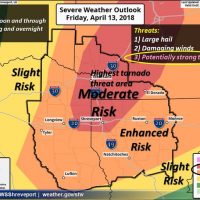
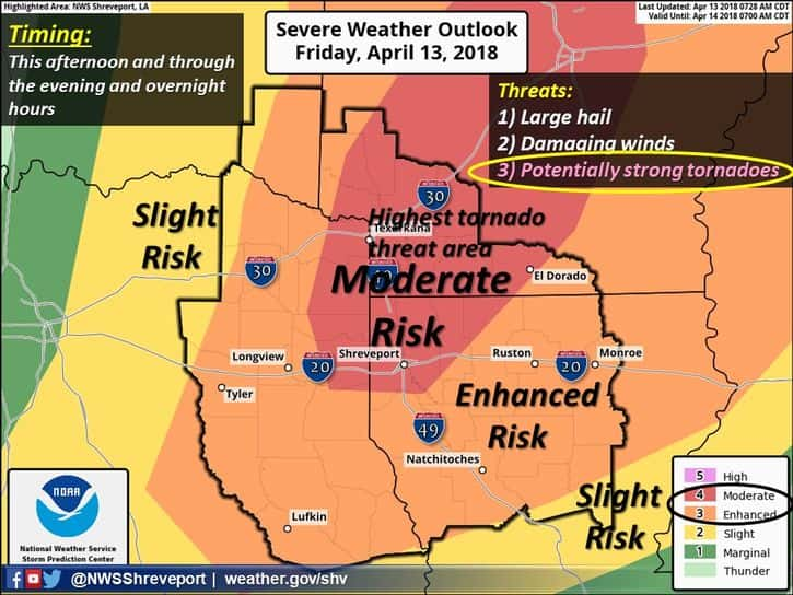
Strong to severe thunderstorms will be developing early this afternoon with the severe weather threat further intensifying by mid to late afternoon through this evening . Much of our region is either in a Moderate Risk or an Enhanced Risk during this timeframe. All modes of severe weather will be possible, including the threat of potentially strong and long track tornadoes. Large hail and damaging winds are also significant threats as well with the possibility of discrete supercells initially during the afternoon with very large hail, eventually evolving into a linear complex of storms with the primary threat of damaging winds later this evening and overnight.
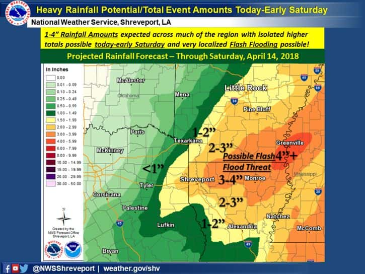
Heavy rainfall of 1-4 inches is forecast across much of the region today through early Saturday with widespread showers and storms developing ahead of a strong cold front. Isolated higher amounts may be possible over parts of North Louisiana and South Arkansas where localized flash flooding can’t be ruled out. However, the main concern with these storms will be the severe potential with threats of large hail, damaging winds, and tornadoes all in the mix.