


Rest Of Today:
Showers and thunderstorms likely. Some thunderstorms may be severe in the afternoon. Mostly cloudy. Highs in the lower 80s. South winds 10 to 15 mph. Gusts up to 25 mph in the afternoon. Chance of precipitation 60 percent.
Tonight:
Showers and thunderstorms likely in the evening, then a chance of showers and thunderstorms after midnight. Some thunderstorms may be severe in the evening. Mostly cloudy. Lows in the mid 50s. South winds 5 to 10 mph. Chance of precipitation 70 percent.
Thursday:
A 20 percent chance of showers and thunderstorms in the morning. Mostly cloudy. Cooler. Highs in the lower 70s. Southwest winds 10 to 15 mph.
Hazardous Weather Outlook
National Weather Service Shreveport LA
1103 AM CDT Wed Mar 29 2017
ARZ050-051-059>061-070>073-LAZ001>006-010>014-017>022-OKZ077-
TXZ096-097-108>112-124>126-136>138-149>153-165>167-301615-
Sevier-Howard-Little River-Hempstead-Nevada-Miller-Lafayette-
Columbia-Union-Caddo-Bossier-Webster-Claiborne-Lincoln-De Soto-
Red River-Bienville-Jackson-Ouachita-Sabine-Natchitoches-Winn-
Grant-Caldwell-La Salle-McCurtain-Bowie-Franklin-Titus-Camp-
Morris-Cass-Wood-Upshur-Marion-Smith-Gregg-Harrison-Cherokee-Rusk-
Panola-Nacogdoches-Shelby-Angelina-San Augustine-
1103 AM CDT Wed Mar 29 2017
This Hazardous Weather Outlook is for portions of south central
Arkansas…southwest Arkansas…north central Louisiana…
northwest Louisiana…southeast Oklahoma…east Texas and
northeast Texas.
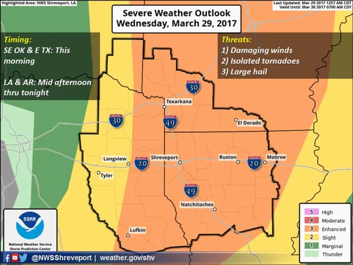
.DAY ONE…Today and Tonight…
The line of showers and thunderstorms has diminished late this
morning as it encountered a more stable airmass. However, convective
boundaries leftover from these showers and thunderstorms, in
addition to a strong upper level storm system and associated cold
front approaching from the west, should result in the development
of scattered showers and thunderstorms late this afternoon and
especially this evening over portions of extreme Eastern Texas,
Western Louisiana, and Southwest Arkansas, which should increase
in coverage and intensity as they move into north central
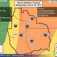
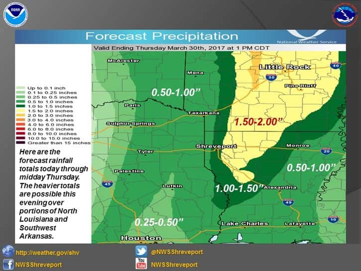
Louisiana. Damaging winds, large hail, isolated tornadoes, and
locally heavy rainfall will be possible, with the severe weather
threat diminishing from west to east later this evening through
the overnight hours.